Case Study: Kings Hall Church Fire Survey, Southall | Digital Twin & Point Cloud
Project Overview
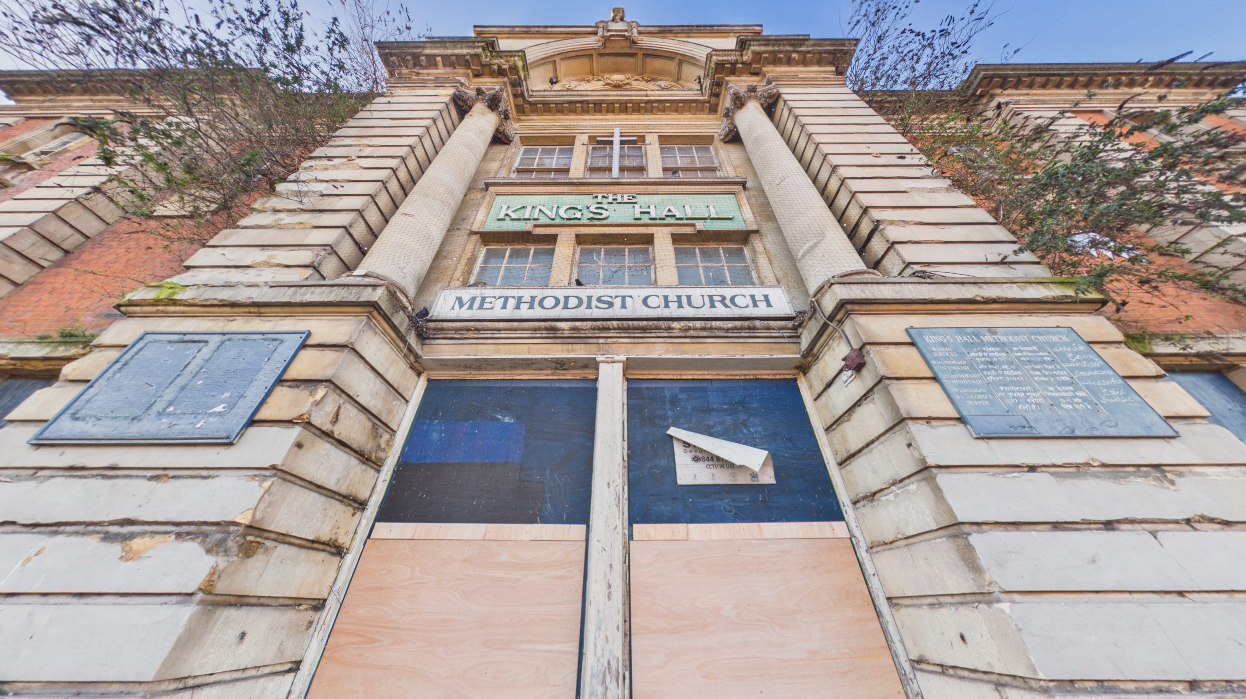
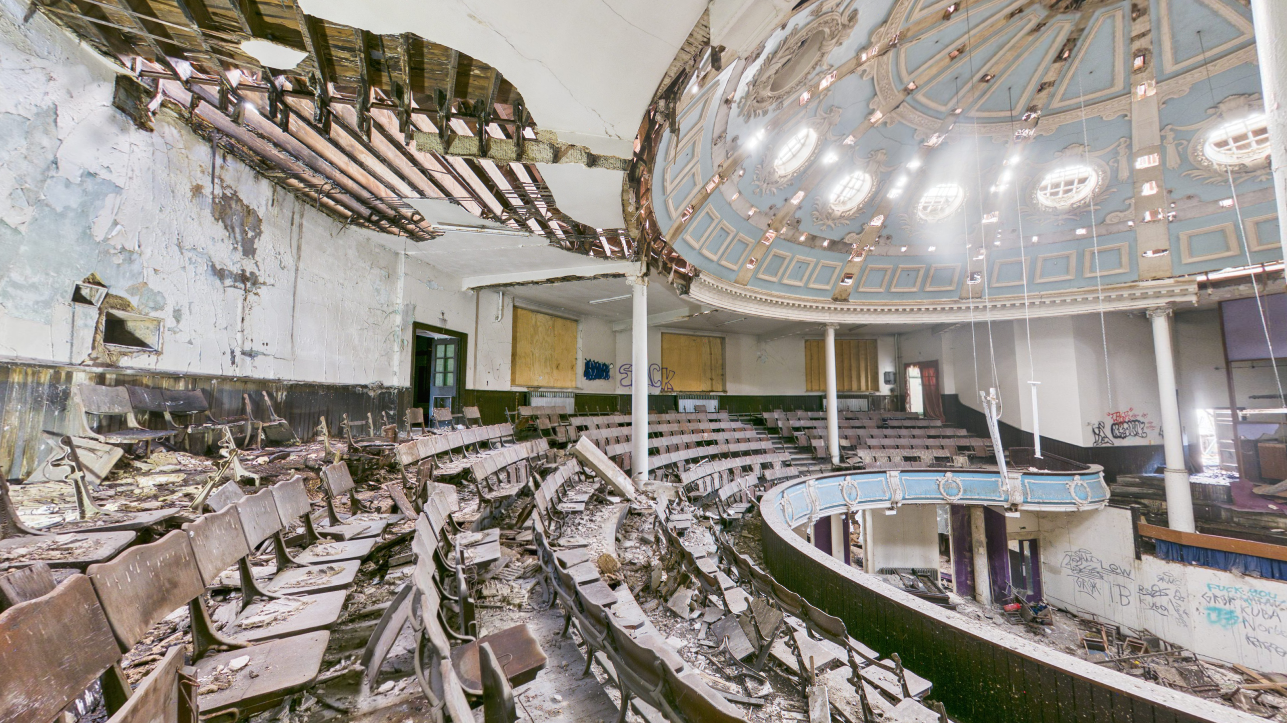
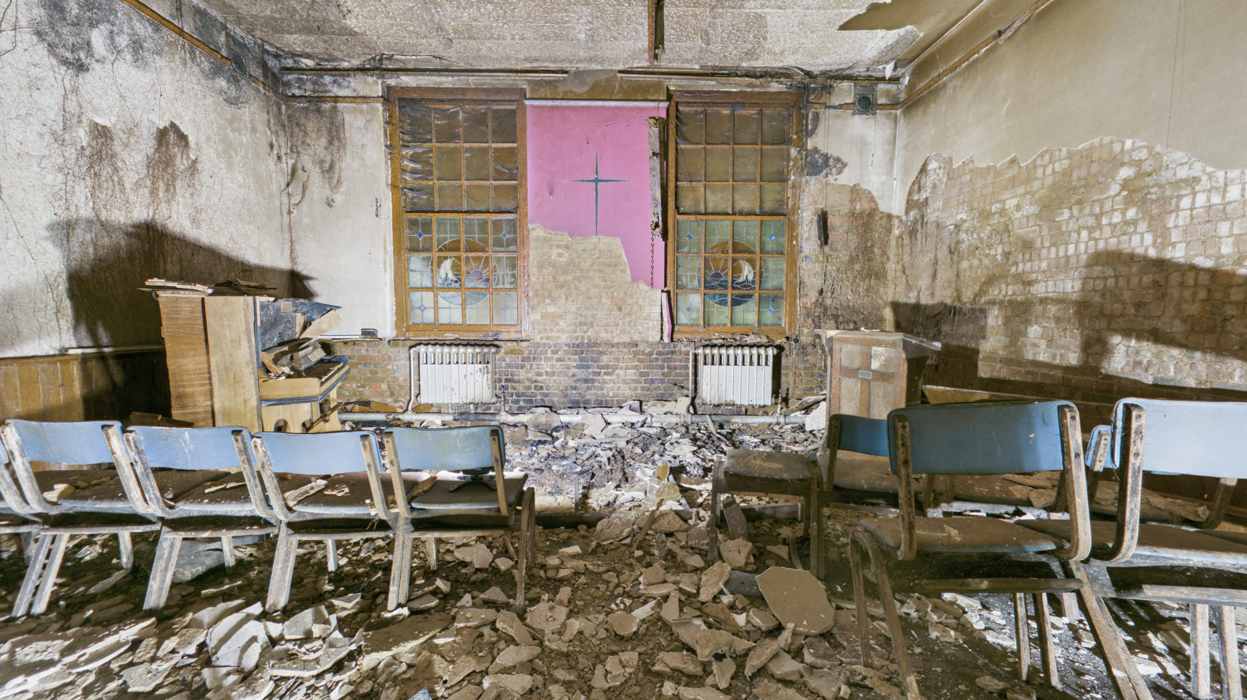
Following a devastating fire at the Grade II listed Kings Hall Church in Southall, London, Rotorgraph Surveys Ltd was instructed by the project architect to create a comprehensive digital record of the fire-damaged structure.
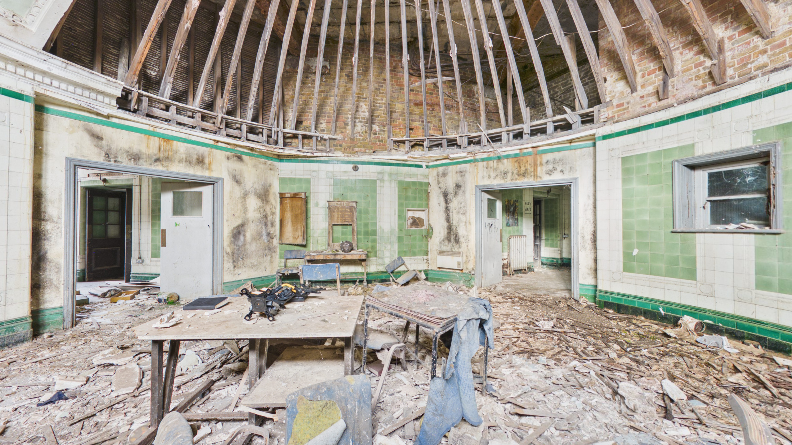
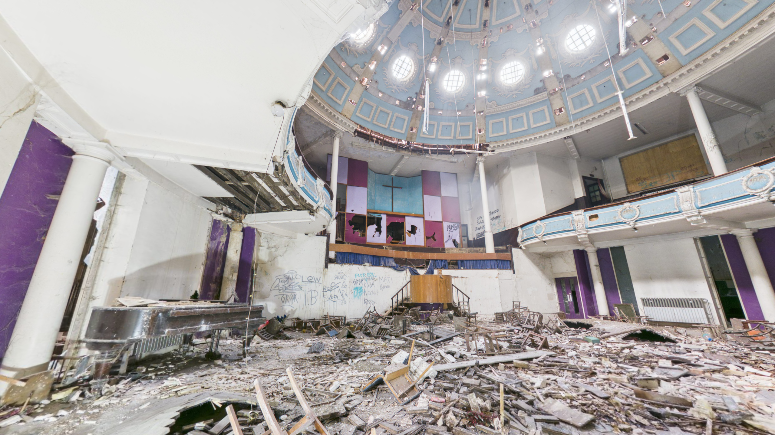
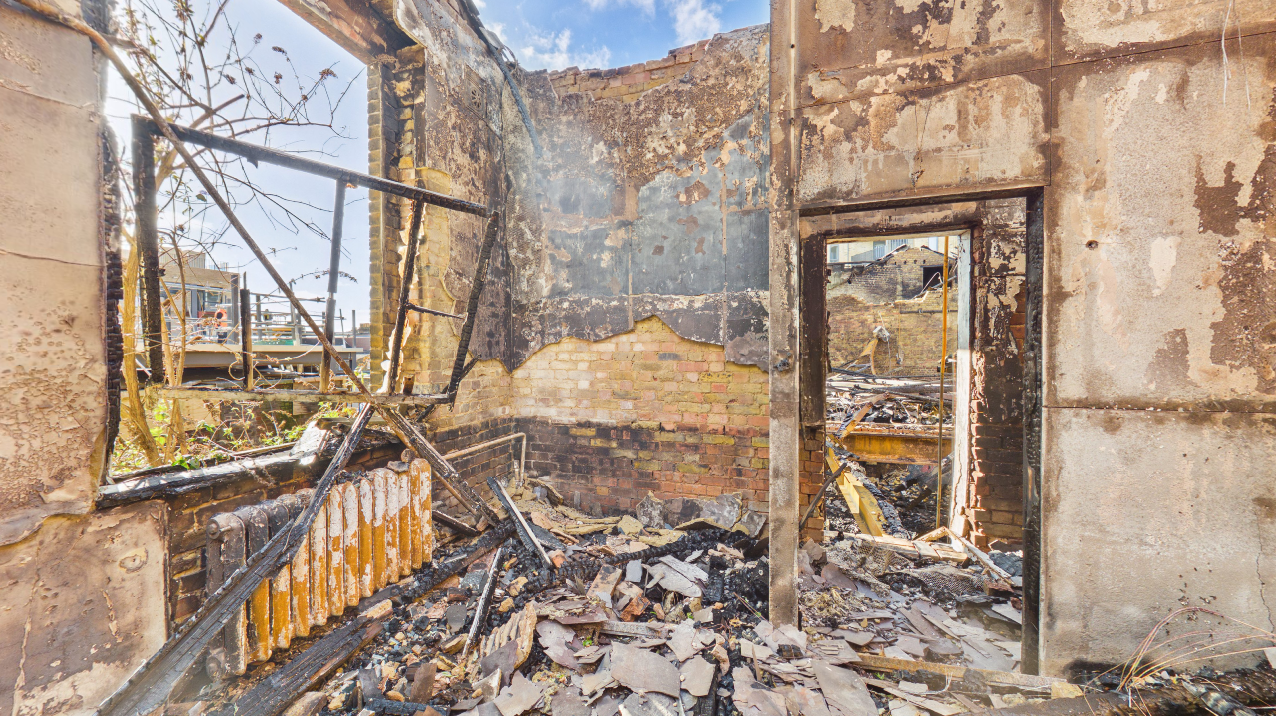
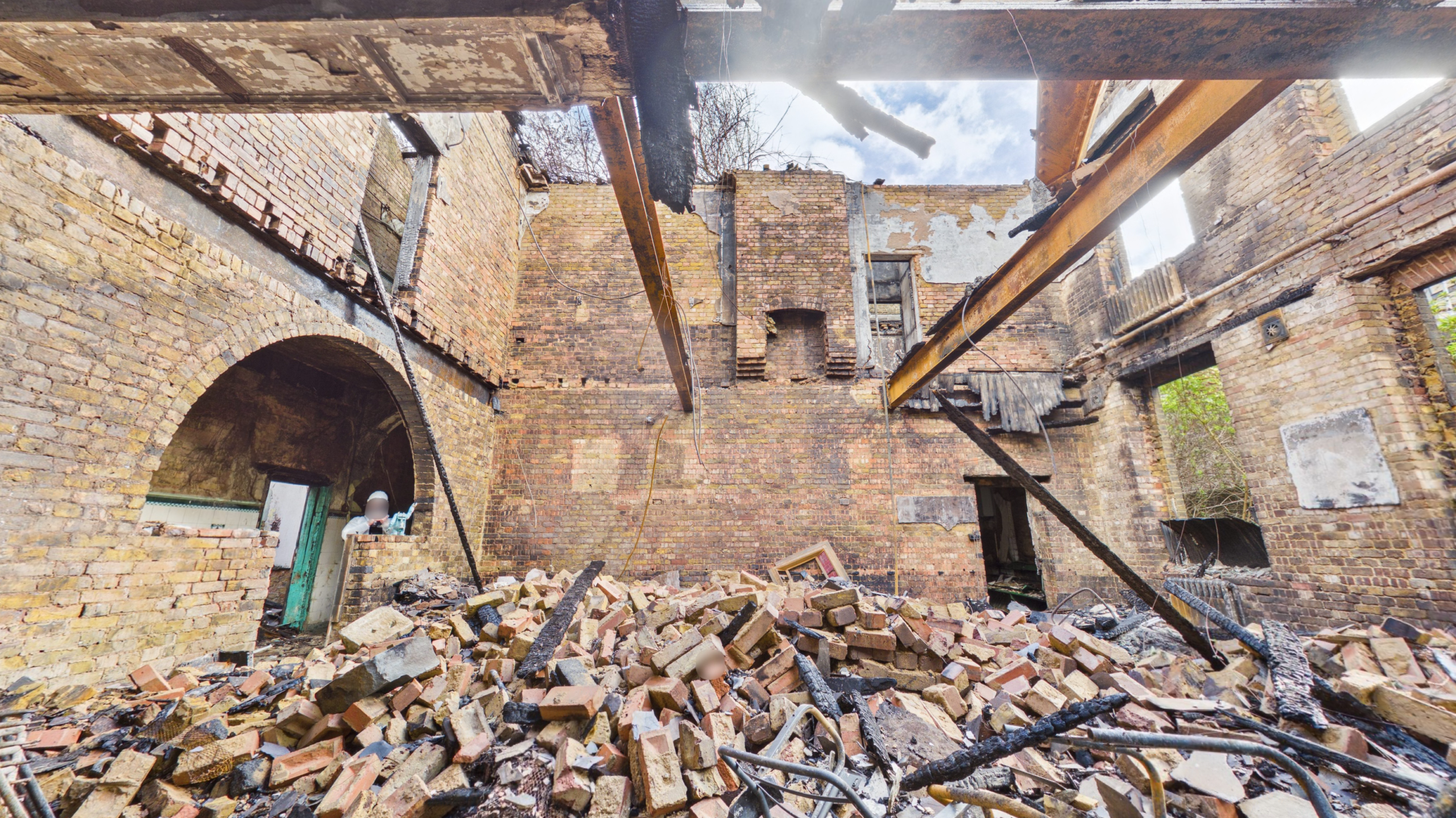
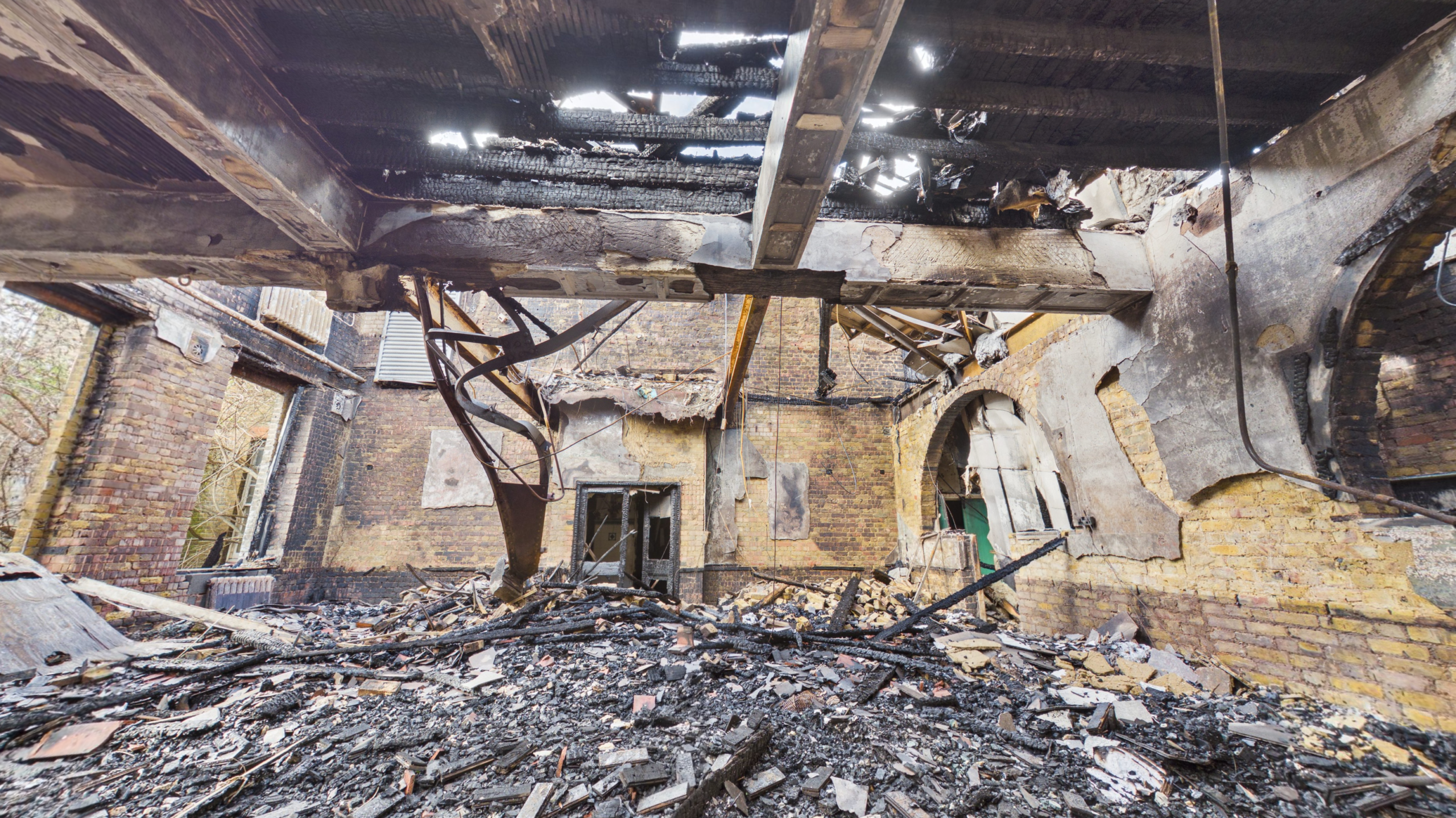
Originally constructed in 1916 and designed by renowned architect Sir Alfred Gelder, Kings Hall had been a prominent Southall landmark for more than a century. Following the fire, which caused extensive damage to large sections of the building including the roof and upper floors, stakeholders required an accurate and measurable record of the property’s condition to support ongoing assessment, planning and future reinstatement works.
To achieve this, Rotorgraph carried out an internal 360° virtual tour and point cloud survey to create a fully navigable digital twin of the building, alongside an external photogrammetry survey to produce a detailed and measurable 3D model of the structure.
The resulting datasets provided architects, surveyors, contractors and other stakeholders with remote access to the property, allowing them to review fire damage in detail, take measurements and assess affected areas without the need for repeated site visits.
By combining multiple survey technologies into a single project, Rotorgraph delivered a permanent digital record of a significant historic building at a critical point in its recovery, helping support informed decision-making throughout the assessment and reinstatement process.
The Objective
Following the fire, the primary objective was to create an accurate and comprehensive digital record of Kings Hall Church before further deterioration, clean-up operations, strip-out works and structural investigations altered the condition of the building.
The project architect required a measurable dataset that would allow stakeholders to remotely assess the extent of the fire damage, review affected areas in detail and support the development of repair and reinstatement strategies. Given the scale of the damage and the historic significance of the Grade II listed building, it was essential that the property’s condition was documented as accurately as possible at this critical stage.
In addition to preserving a permanent record of the structure, the survey needed to provide accessible information that could be shared between architects, surveyors, contractors, insurers and other project stakeholders, reducing the need for repeated site visits whilst ensuring all parties were working from the same reliable dataset.
The ultimate goal was to provide a detailed digital twin and external 3D model of the property that could support assessment, planning, collaboration and decision-making throughout the recovery and reinstatement process.
Our Approach
To ensure a complete and accurate record of the building was captured, Rotorgraph Surveys adopted a multi-layered approach combining internal and external survey technologies.
Internally, we carried out a comprehensive 360° virtual tour and point cloud survey throughout the accessible areas of the church. This enabled the creation of a fully navigable digital twin, allowing stakeholders to remotely walk through the building, review fire-damaged areas and access accurate spatial data long after the site visit had been completed.
Externally, we deployed drone-based photogrammetry techniques to capture hundreds of high-resolution images of the structure from multiple angles. These images were processed into a detailed and measurable 3D model, providing valuable insight into the condition of the building envelope, roof structure and external fire damage.
By combining these datasets, stakeholders were provided with a complete digital representation of the property, allowing architects, surveyors, contractors and insurers to assess damage, take measurements and collaborate more effectively without relying solely on traditional photographs or repeated site attendance.
This integrated approach ensured that critical information was preserved at a pivotal stage in the building’s recovery, providing a reliable foundation for future assessment, planning and reinstatement works.
Why Early Documentation Matters
Following a major fire, a building can change rapidly as emergency stabilisation works, structural investigations, debris removal and reinstatement activities commence. Whilst these works are essential, they can also alter or remove valuable evidence relating to the building’s condition immediately after the incident.
By creating a comprehensive digital record at the earliest opportunity, stakeholders are able to preserve a permanent snapshot of the property before further changes occur. This enables architects, insurers, surveyors and contractors to revisit the building virtually and access critical information throughout the lifecycle of the project.
Supporting Multiple Stakeholders
One of the key advantages of creating a digital twin and external photogrammetry model is that a single dataset can support numerous stakeholders simultaneously.
The information captured during the survey was made accessible to architects, surveyors, contractors and other project professionals, ensuring all parties were working from the same reliable source of information.
This reduces duplication, improves collaboration and helps stakeholders make informed decisions without relying solely on traditional photographs or repeat site visits.
Creating A Measurable Digital Twin
Unlike conventional photography, a digital twin provides a navigable and measurable representation of the building.
Stakeholders were able to remotely explore the property, review fire-damaged areas and access spatial information without physically attending site. The accompanying point cloud data also provided accurate dimensional information that could be utilised during assessment and planning activities.
For a complex and heavily damaged building such as Kings Hall Church, this level of detail offered significant advantages throughout the recovery process.
Why A Digital Twin was Chosen
Traditional photography captures individual moments in time. A digital twin creates a navigable and measurable representation of the entire property, allowing stakeholders to remotely revisit the building, review damage and access spatial information long after the site visit has been completed
Preserving A Historic Landmark
As a Grade II listed building with more than a century of history, Kings Hall Church represents an important part of Southall’s architectural and community heritage.
The survey not only documented the extent of the fire damage but also preserved a detailed digital record of the building at a significant moment in its history. This information may continue to provide value throughout future restoration, conservation and reinstatement works.
Deliverables Provided
The project combined multiple surveying technologies to create a complete digital record of the building’s condition following the fire:
- Internal 360° Virtual Tour
- Registered Point Cloud Survey
- Digital Twin Creation
- External Drone Photogrammetry Model
- High-Resolution Elevation Outputs
- Measurable Building Data
- Remote Stakeholder Access
- Fire Damage Documentation
- Heritage Building Record
These deliverables allowed the project team to safely review the structure remotely while providing accurate data for assessment, planning and future restoration considerations.


