Case Study: Major Industrial Fire, Burnley, Lancashire | Digital Twin & Point Cloud
Supporting Insurers, Loss Adjusters & Contractors Following A Significant Manufacturing Facility Fire
Project Overview
Following a significant fire at a large industrial manufacturing facility in Lancashire, Rotorgraph Surveys was instructed to undertake a comprehensive digital documentation survey of the affected areas.
The project formed part of the wider recovery and assessment process, requiring accurate property information to be made available to insurers, loss adjusters, contractors, consultants and project teams responsible for planning the next stages of the recovery works.
The scale of the incident, combined with the complexity of the manufacturing environment, created a requirement for far more than traditional photography. Stakeholders needed a solution that would preserve conditions, provide measurable data and allow remote access to the site long after physical conditions began to change.
Rotorgraph Surveys was selected to create a complete digital record of the property through a combination of 360° virtual tours, point cloud surveying, digital twin creation and floor plan production.
Project Objectives
The primary objective was to create a permanent and highly accurate record of the affected areas before significant recovery, strip-out and reinstatement works commenced.
Key project objectives included:
• Preserve site conditions following the fire
• Create a measurable digital record of the property
• Reduce the need for repeated stakeholder site visits
• Support insurers and loss adjusters during the assessment phase
• Assist contractors and consultants with recovery planning
• Provide accurate floor plans and spatial information
• Improve collaboration between multiple project stakeholders
• Enable remote access to the property from any location
• Capture information safely within a challenging post-fire environment
Survey Methodology & Site Challenges
Capturing accurate information within a fire-damaged industrial facility requires far more than simply arriving on site with a scanner.
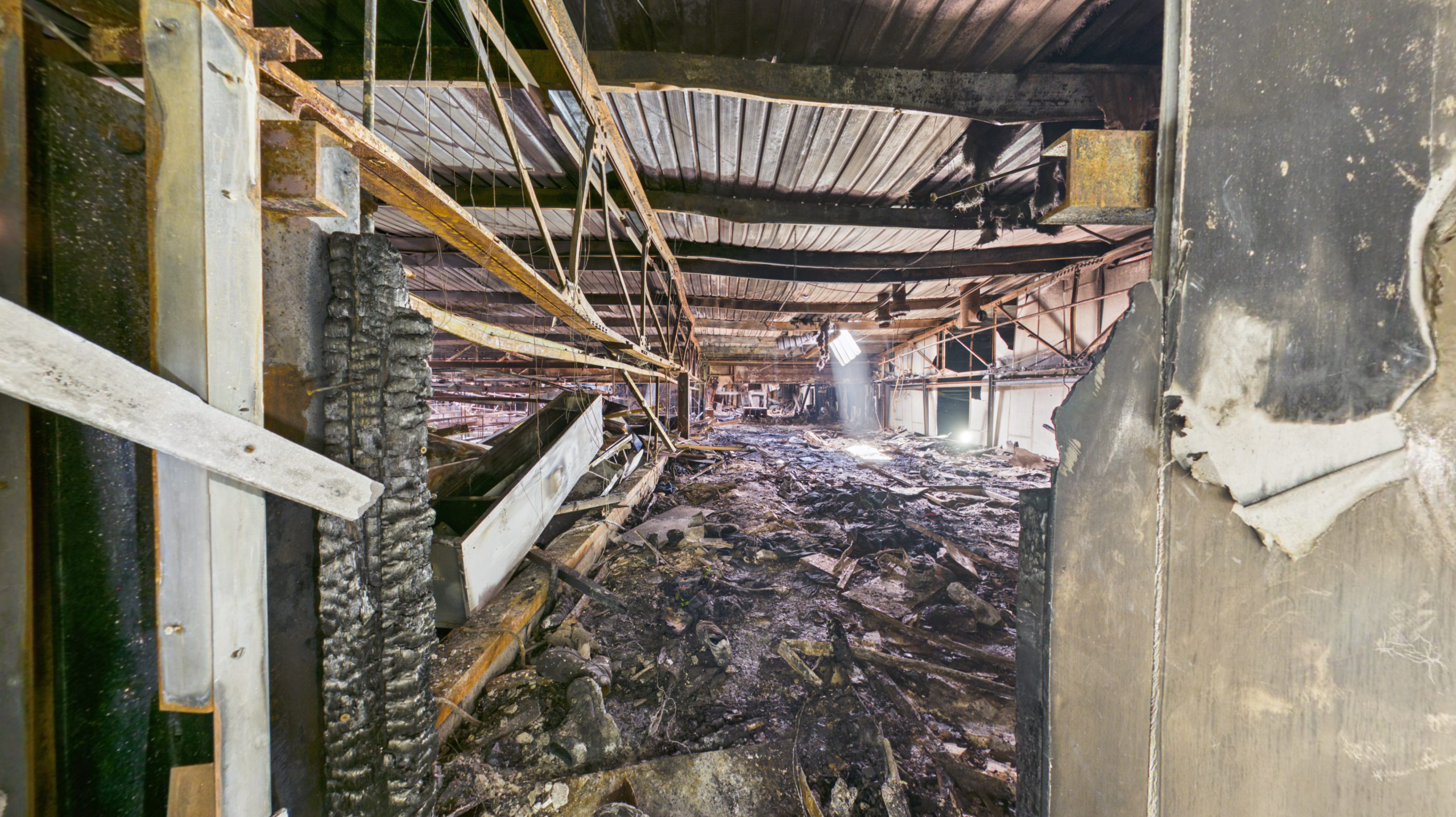
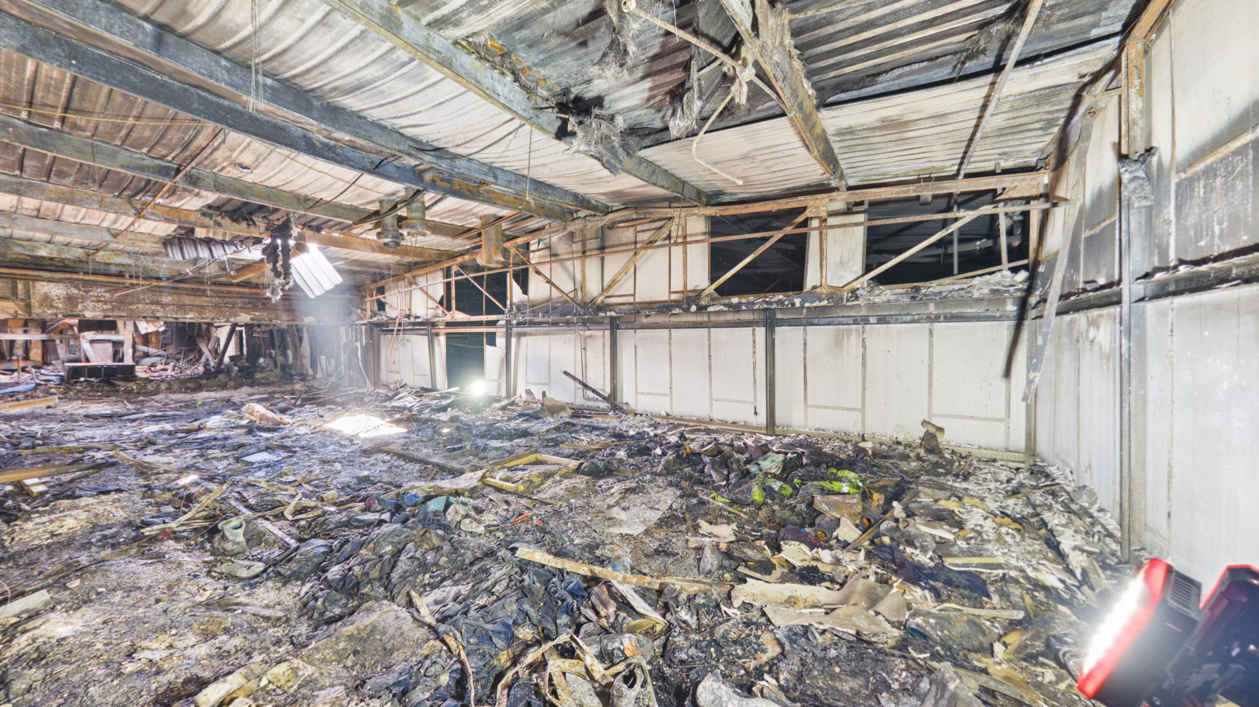
Large sections of the building had been left without operational lighting following the incident, leaving extensive areas in complete darkness. In many locations, structural damage, debris and restricted access routes created additional challenges for both navigation and data capture.
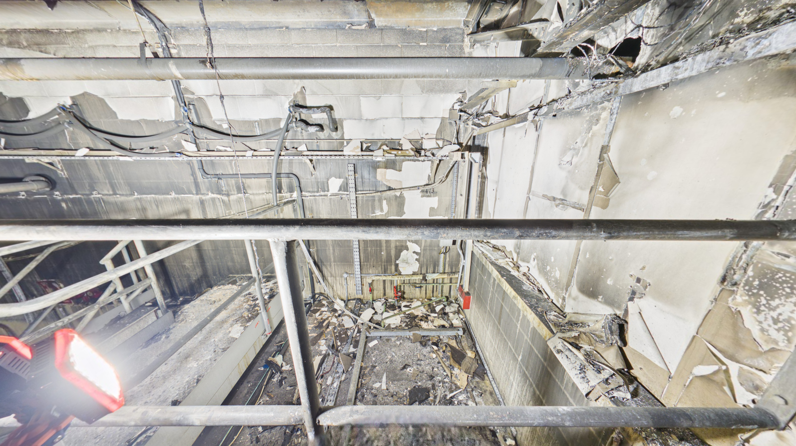
To ensure the highest quality outputs, Rotorgraph Surveys deployed specialist high-output survey lighting throughout the project. This allowed fire-damaged areas, machinery, structural elements and internal spaces to be accurately documented whilst maintaining the image quality required for digital site record creation and point cloud generation.
The use of specialist lighting proved critical in preserving detail within the affected areas and ensured stakeholders would later be able to clearly review conditions remotely without information being lost within poorly lit environments.
The Challenge
Large industrial fire losses present unique challenges when compared to conventional property surveys.
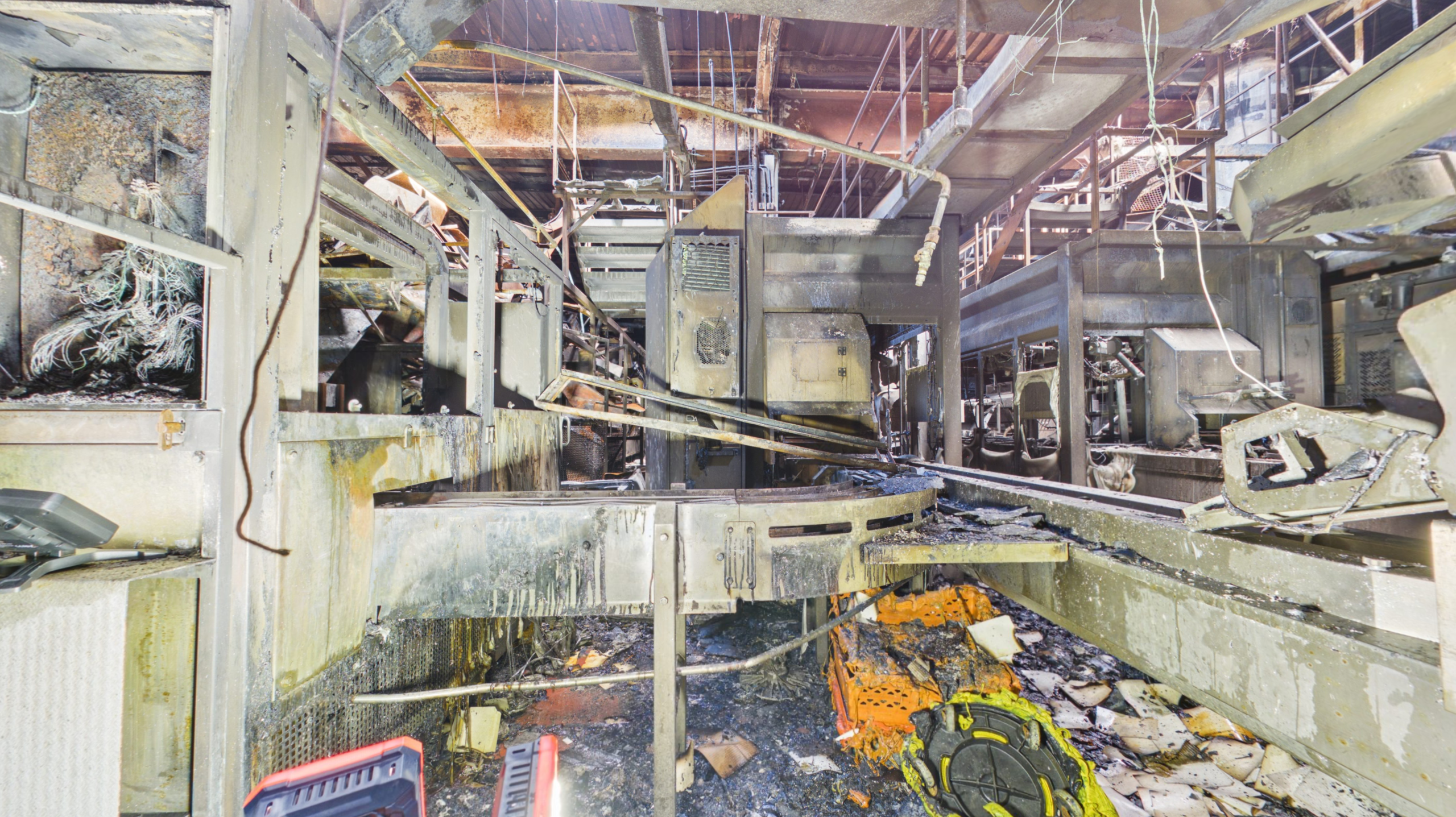
The affected areas formed part of a substantial manufacturing facility containing large open spaces, damaged production areas and sections where operational infrastructure had been compromised as a result of the fire.
Many areas had little or no usable lighting, whilst others contained debris, damaged building elements and restricted access routes. The building remained part of an active operational environment, requiring survey works to be carefully coordinated around site activities and ongoing recovery operations.
Traditional photography would have provided only a limited record of the damage and would have required stakeholders to repeatedly attend site to review conditions.
The client therefore required a solution capable of creating a complete and measurable digital representation of the affected areas whilst preserving a permanent record of conditions at a specific point in time.
Our Approach
Rotorgraph Surveys deployed specialist scanning technology alongside specialist lighting equipment to undertake a systematic survey of both internal and external areas.
The project required careful planning to ensure complete coverage of the affected areas whilst maintaining safe working practices throughout the survey process.
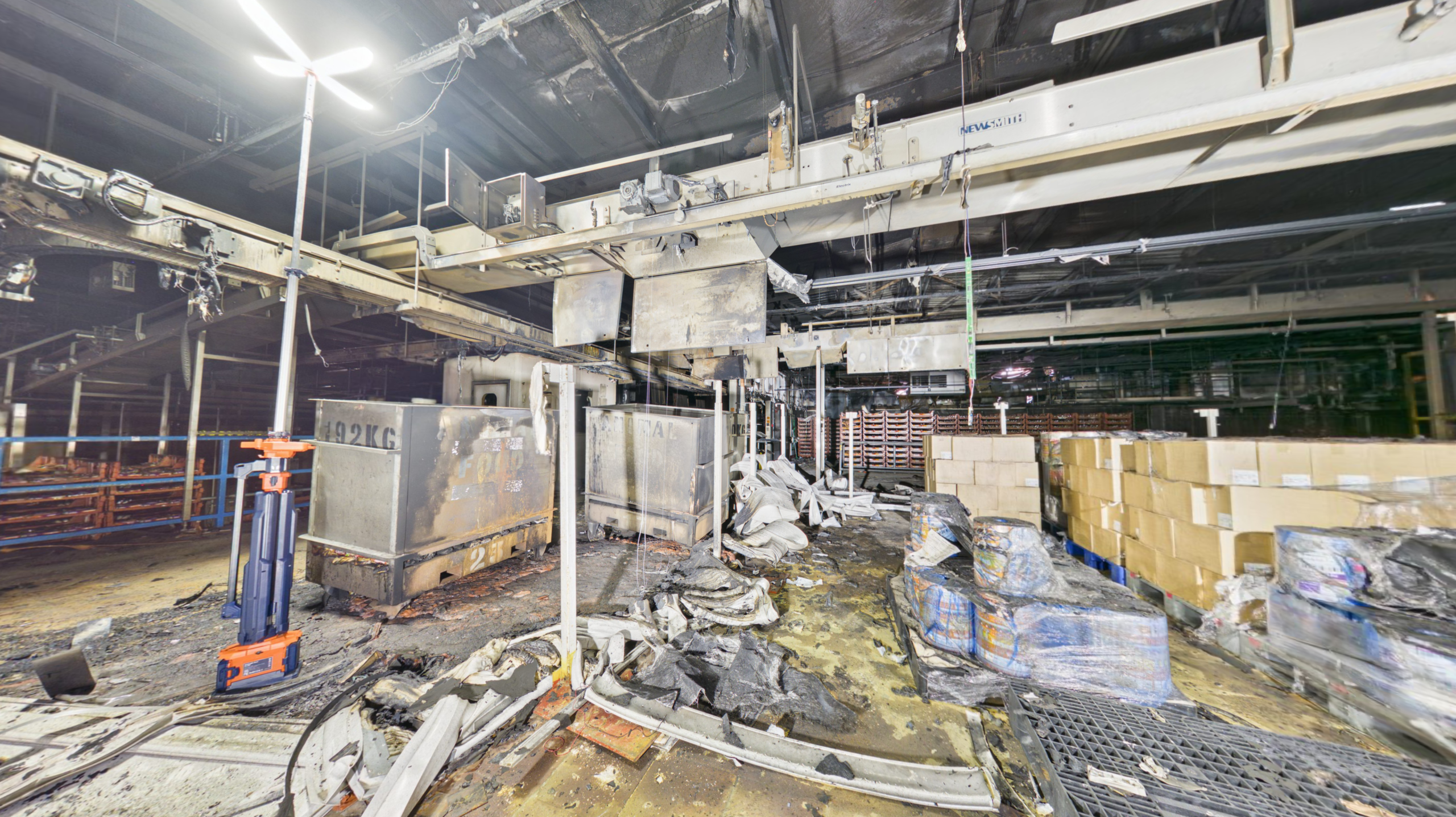
One of the most significant challenges involved the absence of operational lighting within large sections of the building. To overcome this, specialist high-output lighting systems were introduced to illuminate key areas, allowing accurate capture of structural elements, machinery, building services and fire-damaged surfaces that would otherwise have remained hidden in darkness.
Working methodically through the facility, thousands of individual data points were captured and combined to create a highly detailed measurable building model and accompanying point cloud survey.
This approach ensured stakeholders would be able to remotely navigate the property, inspect conditions, verify measurements and review damage without repeatedly attending site.
Collaboration With The Site Health & Safety Team
One of the key factors contributing to the success of the project was the close collaboration between Rotorgraph Surveys and the site’s Health & Safety team.
Following a major fire incident, access to damaged areas must be carefully managed to ensure survey activities can be completed safely whilst protecting all personnel on site.
Throughout the project, the Health & Safety team provided invaluable support, guidance and local knowledge of the building. Their assistance helped identify safe access routes, manage changing site conditions and ensure all survey activities were carried out in accordance with site safety procedures.
Their professionalism and commitment to safety not only helped protect everyone involved but also allowed the survey team to efficiently navigate a challenging environment and complete a comprehensive digital record of the facility.
We would like to extend our sincere thanks to the site team, whose support played a significant role in the successful delivery of the project.
Creating A Measurable Digital Twin
Unlike conventional photography, a digital twin creates a fully navigable and measurable representation of the property.
Stakeholders were able to remotely move throughout the building, inspect fire-damaged areas, review building layouts and access valuable information from any location.
The accompanying point cloud survey provided accurate spatial data capable of supporting measurement exercises, planning activities and future recovery works.
For a project of this scale, the ability to revisit the site remotely represented a significant advantage for insurers, loss adjusters, contractors and consultants involved in the ongoing recovery process.
Deliverables Provided
Rotorgraph Surveys delivered a complete digital documentation package including:
• Internal 360° Virtual Tour
• External 360° Documentation
• Registered Point Cloud Survey
• Measurable Digital Twin
• Floor Plans
• Remote Stakeholder Access
• Fire Damage Documentation
• Major Loss Property Record
• Accurate Spatial Data For Planning & Assessment
Project Outcomes
The completed digital twin / survey dataset and point cloud survey created a single source of reliable information for all project stakeholders.
The deliverables enabled:
• Remote inspection of affected areas
• Improved collaboration between project teams
• Reduced repeat site attendance
• Faster access to critical information
• Accurate measurement without returning to site
• Preservation of site conditions before reinstatement
• Support for recovery and reinstatement planning
• Improved visibility throughout the claim lifecycle
By providing stakeholders with a permanent digital record of the property, the project demonstrated how modern surveying technology can significantly improve communication, efficiency and decision-making following a major loss event.
Conclusion
Major industrial fire losses often involve numerous stakeholders, rapidly changing site conditions and complex recovery programmes.
Through the use of digital twin technology, point cloud surveying, specialist lighting and close collaboration with the site’s Health & Safety team, Rotorgraph Surveys successfully created a comprehensive and measurable digital record of the affected facility.
The resulting dataset continues to provide long-term value to insurers, loss adjusters, contractors and consultants by preserving critical information, improving accessibility and supporting informed decision-making throughout the recovery and reinstatement process.
Project Snapshot
Sector: Industrial Manufacturing
Location: Lancashire, UK
Property Type: Large Manufacturing Facility
Incident Type: Major Fire Damage
Technology Used: Point Cloud Surveying, Digital Twin Creation & Specialist Survey Lighting
Stakeholders: Insurers, Loss Adjusters, Contractors, Consultants & Project Teams
Outcome: Complete Digital Record Supporting Assessment, Recovery & Reinstatement Planning


