
When a major fire affects a historic building, the period immediately afterwards is critical. The structure may be unsafe, the condition can change rapidly as emergency works begin, and the teams involved need a common, reliable record from which to make decisions.
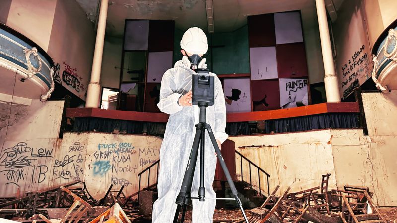
At Kings Hall Church on South Road in Southall, Rotorgraph was instructed by the project architect to create a comprehensive digital record following the February 2026 fire. The survey combined an internal 360° virtual tour, registered point cloud capture and external drone photogrammetry to give the wider team a navigable, measurable record of the accessible structure.
Kings Hall Church before the fire
Kings Hall Methodist Church was completed in 1916 and is a Grade II-listed building. It was designed by Sir Alfred Gelder, of the Gelder and Kitchen practice, and has been a notable Southall landmark for more than a century. Historical accounts record that the building served as a Methodist mission and, for a period in the 1920s and 1930s, operated as a cinema before returning to church use.
Its listed status made an accurate post-incident record particularly important. On a heritage asset, documentation is not simply about visible damage; it can preserve information that may assist future conservation, design, repair and reinstatement decisions.
The Southall fire: verified incident timeline
London Fire Brigade received the first of more than 20 calls at 21:30 on Sunday 22 February 2026. Ten fire engines and around 70 firefighters attended the derelict church. At the height of the incident, most of the ground floor, first floor, second floor and roof were alight.
Two 32-metre turntable ladders were deployed as water towers to tackle the fire from above. The fire was brought under control at 00:38, although crews remained on site into the following afternoon to extinguish hotspots before handing the site to partner agencies.
London Fire Brigade reported no injuries. It also confirmed that the roof and upper floors had collapsed, and that the local authority had declared the building structurally unsafe. The Brigade stated there was no risk to surrounding properties.
Why early fire-damage documentation matters
After a serious fire, the building condition recorded on day one can be very different from the condition after emergency stabilisation, debris removal, strip-out and structural investigation. Those later works are essential, but they can alter or remove evidence that architects, insurers, engineers and contractors need to understand.
The objective at Kings Hall was therefore to create a clear baseline before further changes took place. The result was a permanent digital record that could be revisited by the project team without relying only on isolated photographs or repeat attendance at a hazardous site.
What Rotorgraph recorded at Kings Hall Church
- Internal 360° virtual tour: a navigable visual record of accessible spaces.
- Registered point cloud: measurable spatial information to support assessment and design work.
- External drone photogrammetry: high-resolution imagery processed into a detailed, measurable 3D model of the building envelope and external fire damage.
- High-resolution elevation outputs: clear visual reference material for architects, surveyors and contractors.
- Remote stakeholder access: a shared record that reduced the need for unnecessary returns to site.
From emergency response to recovery planning
The digital record was created to support the recovery process, not to replace specialist investigations. Structural safety assessments, fire investigations, conservation advice and repair design remain the responsibility of the appropriately appointed professionals.
What the survey provides is a common evidence base. Architects can review geometry and condition; surveyors can interrogate imagery and measurements; insurers and loss adjusters can understand the recorded extent of visible damage; and contractors can plan work with a clearer picture of access and risk.
Following the fire, a planning application was validated in May 2026 for site-safety measures including perimeter security fencing, CCTV and re-boarding windows. This illustrates how the immediate response to a fire can develop into a longer programme of securing, assessing, stabilising and planning for the future.
A practical model for fire-damaged and heritage buildings
Kings Hall demonstrates how 360 capture, point cloud surveying and drone photogrammetry can work together after a major incident. For loss adjusters, architects, building surveyors, conservation teams and contractors, the value is not the technology alone. It is having reliable, measurable evidence at the point when decisions matter most.
For a more detailed overview of the project outputs, see our Kings Hall Church fire survey case study.